The Art Loeb Trail Project is a free resource, created to preserve, protect and cherish the trail for future generations. Dedicated to Arthur J. Loeb, remembered as a man who “deeply loved these mountains.”
The Art Loeb Trail Project provides the most detailed and relevant information available. The three main features are the Trail Map, Trip Planning Guide and Live Weather.
Art Loeb Trail Map
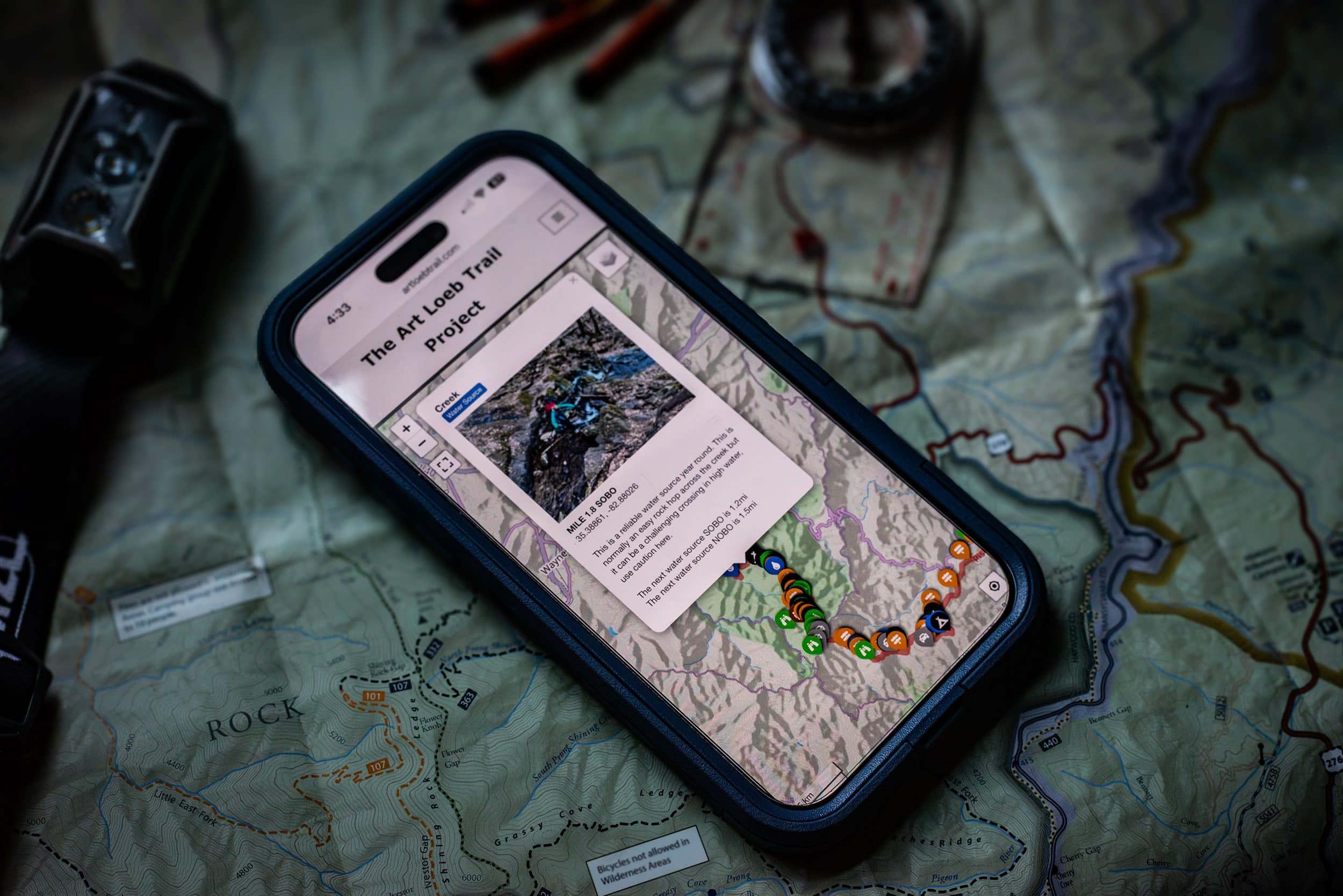
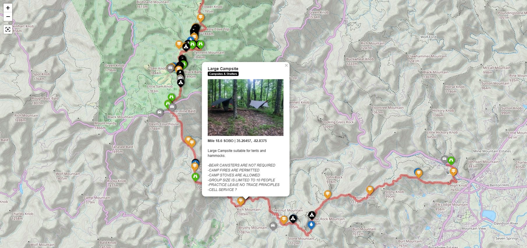
The trail map is the heart of the Art Loeb Trail Project. The detailed map shows campsites, water sources, trail intersections, parking and trail access. Each waypoint has GPS coordinates, distance (measured SOBO) important details along with photos to give you an idea of what to expect.
The embedded map on the website allows you to enable location on your device to see your position on the map. In addition, you should download the complete GPX file with all waypoints for offline navigation using your favorite navigation app like AllTrails, Gaia, Avenza, Garmin, etc.
Campsite details include the size of the site, suitability information for tents and hammocks, nearby water sources, notable features, rules and regulations and images of each campsite.
Water sources shown on the map include the distance from one source to the next reliable source, which typically flow year round. There are a number of other seasonal water sources that will be flowing much of the time except during periods of dry weather. Others only have water flowing after rain or snow.
Side trails, intersections and bail out routes are included in addition to the complete Art Loeb trail. Every trail crossing and intersection includes photos and details, recommended side trips, bail out routes and more. Specific intersections that can be confusing have additional descriptions and images with turn by turn directions.
Parking areas and trail access points are included with details and directions as well as images. There are also links to road conditions and closures.


Trip Planning Guide
The trip planning guide is the go to knowledge base for every aspect of planning your hike. It includes a trail overview with detailed information about, parking and access, shuttles, campsites/shelters, water sources, navigation, weather, emergency preparedness, rules and regulations and Leave No Trace principles. The trip planning guide also includes links to a variety of useful external resources.
It’s the perfect companion to the Trail Map and offers more context about just about every aspect of the Art Loeb Trail for planning a fun, safe and memorable trip.
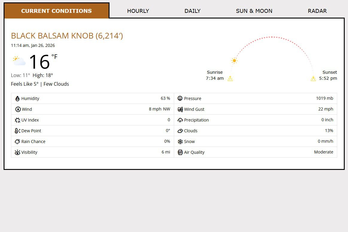
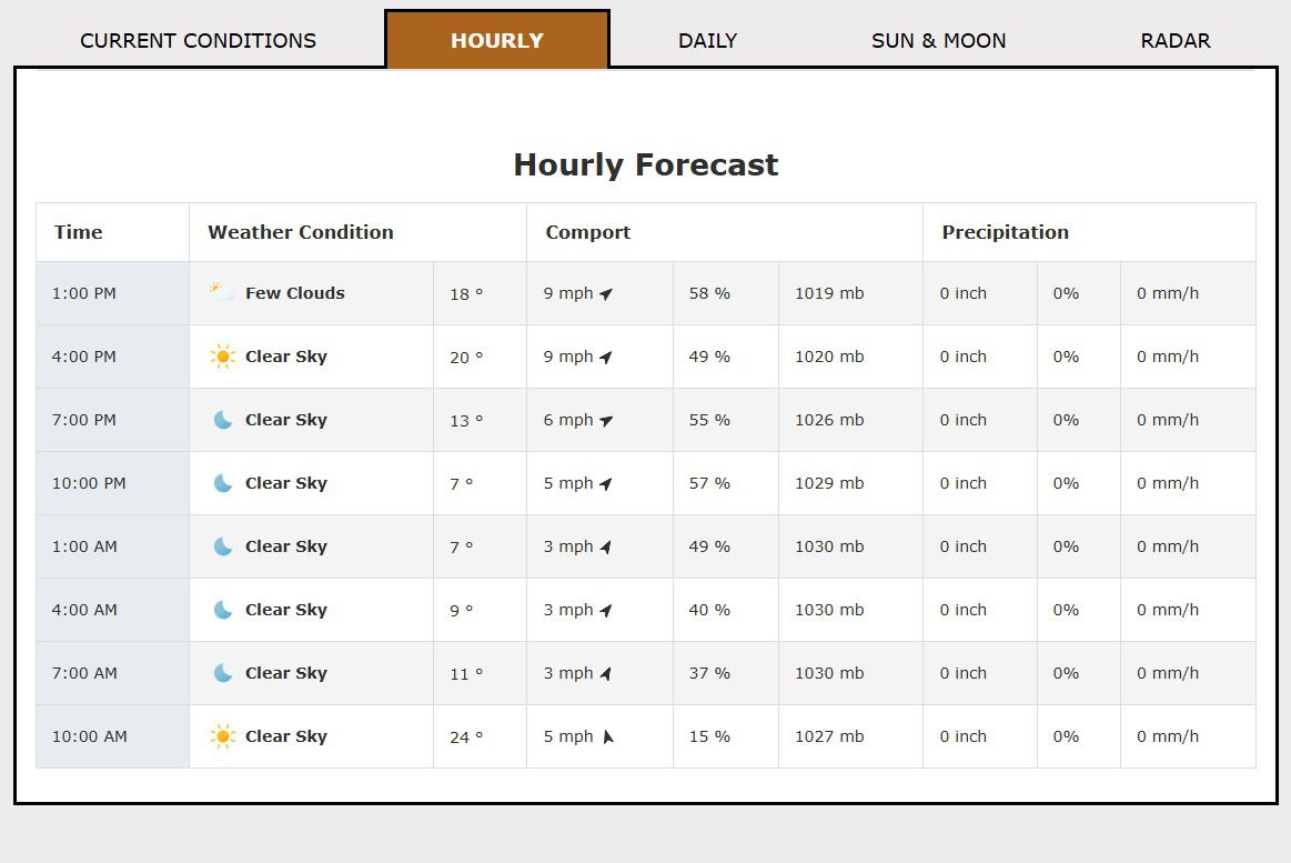
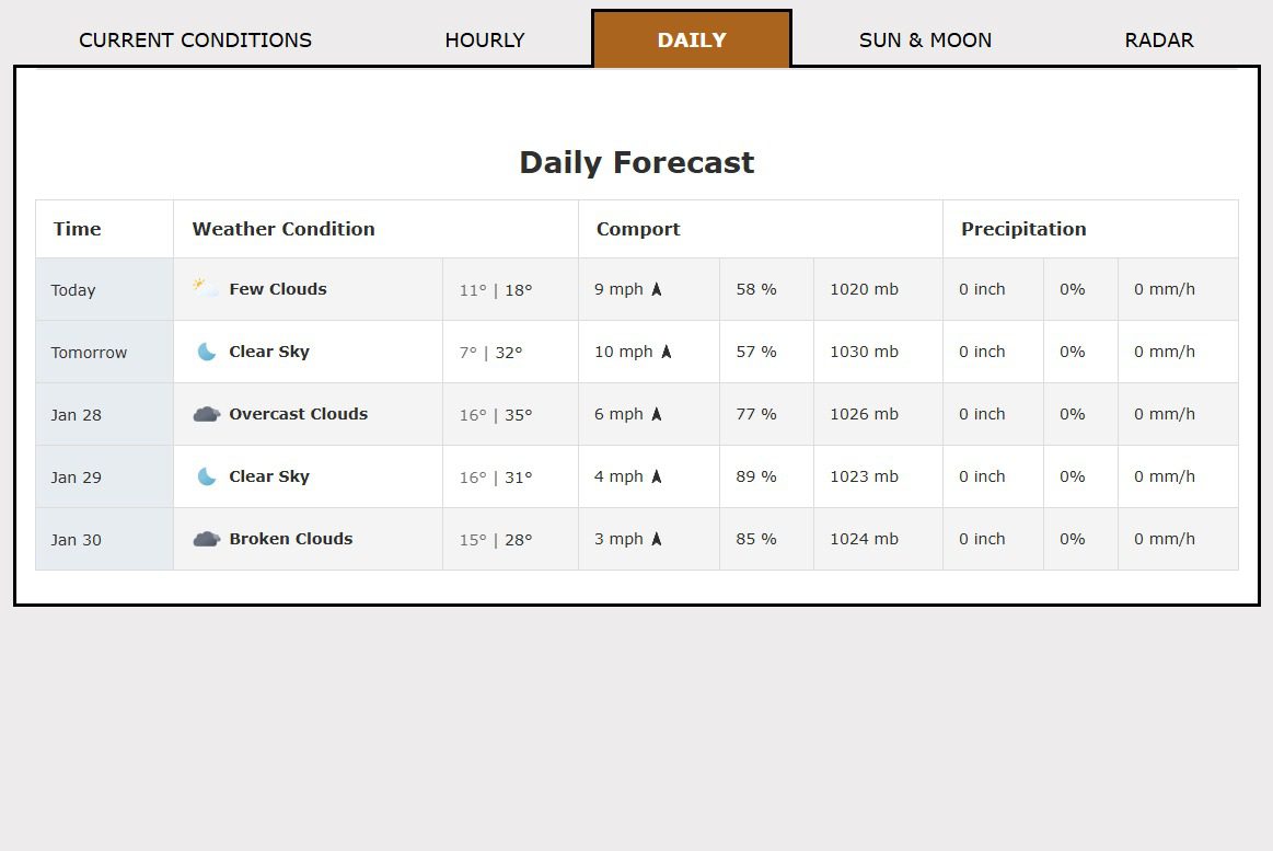
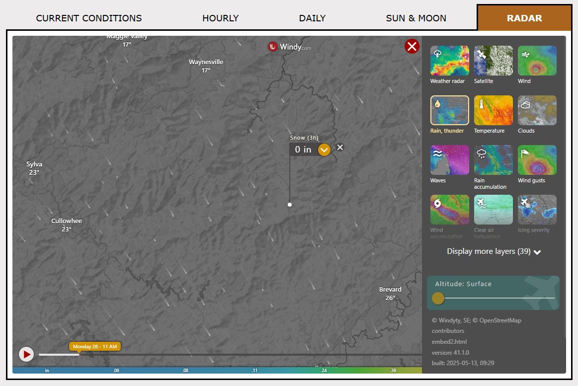
Live Weather
The current weather conditions from five different locations across the trail from the lowest to highest elevations. Keep an eye on the forecast before and during your hike from one dashboard. Features include current conditions, daily/hourly forecast, sun/moon and radar for each location.